Caribbean Handbook on Risk Management
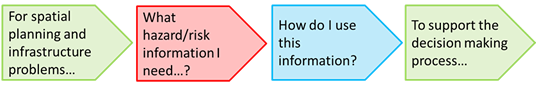
The aim of this on-line handbook is to support the generation and application of landslide and flood hazard and risk information to inform projects and program of planning and infrastructure sectors, specifically targeted to small countries in the Caribbean region. The methodology centers around a series of use cases, which are practical examples
 .
.
The handbook is made of 3 interlinked components:
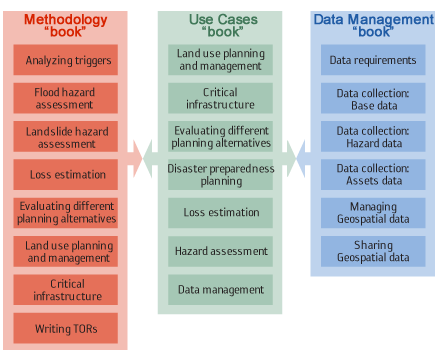
Use case book, which illustrates the steps required to use the hazard and risk information in so-called use cases (example) for planning of infrastructure, planning of risk reduction measures, emergency preparedness and emergency response. A number of these examples consist of actual step-by-step exercises which also contain data, and which use an Open source GIS software.
Methodology book, which focuses on the methods for generating landslide and flood hazard and risk information for different scales (nationwide, and for detailed areas) and taking into account different situations of data availability.
Data management book, which indicates the aspects related to use collection, management and sharing of spatial data related to landslide and flood hazard and risk and planning. This book will detail the types and quality of data needed for activities at different scales and methods for data creation and sharing.